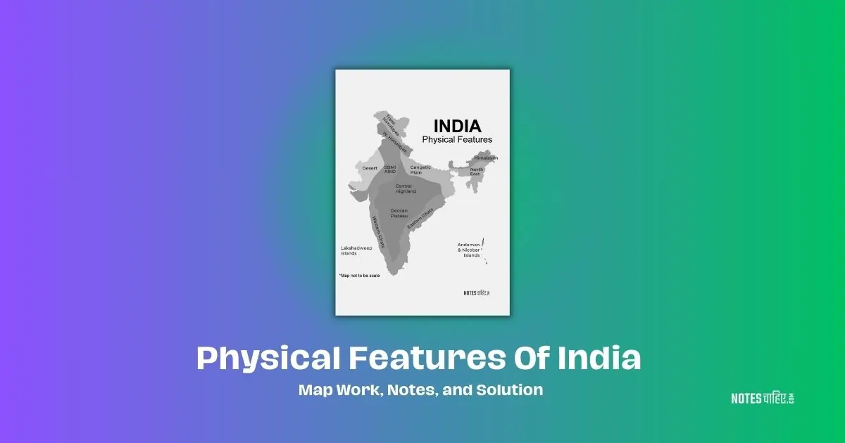
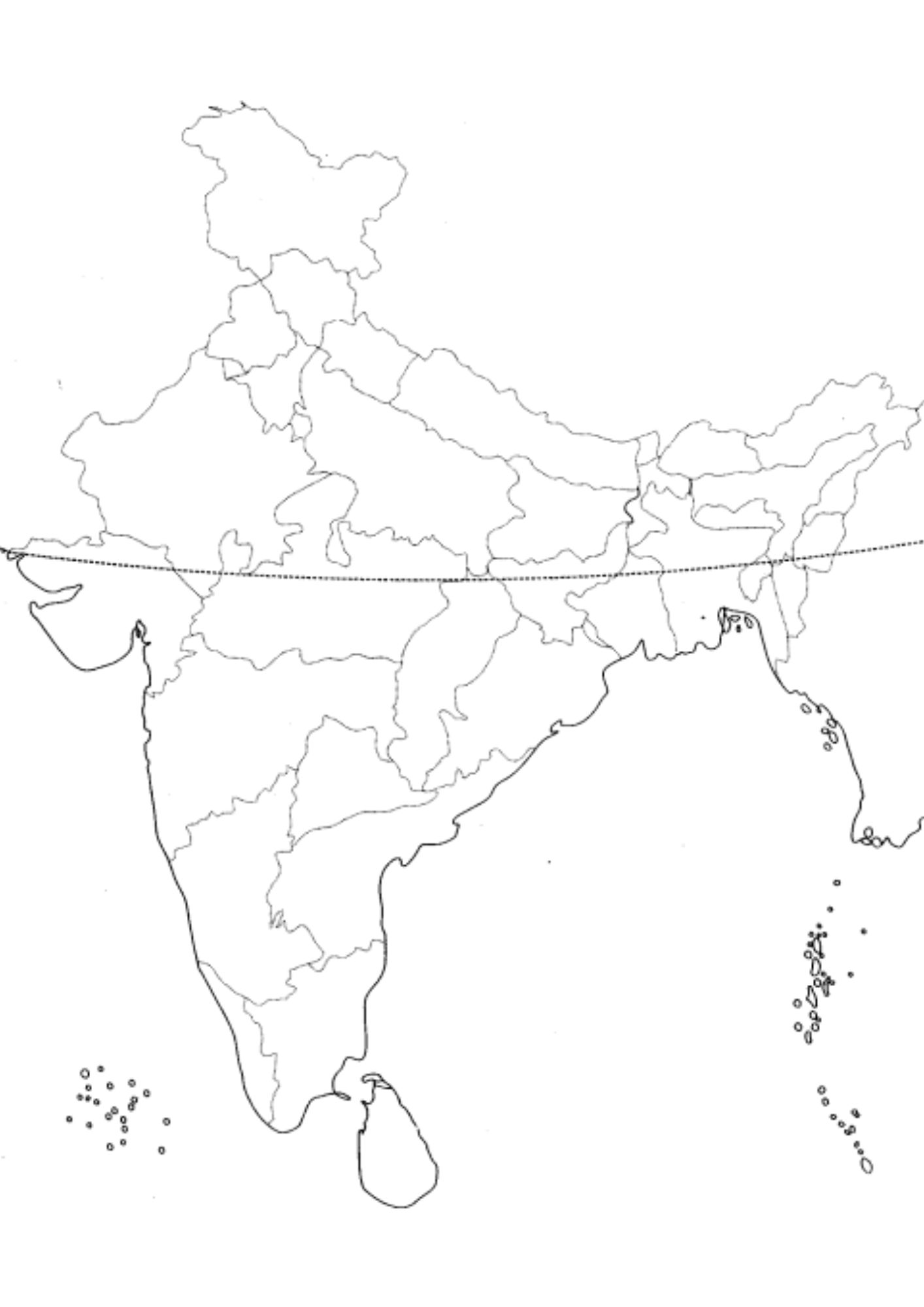
Class 9 Map Of Physical Features Of India is a very important chapter of Geography. In this chapter, you can get the valuable knowledge such as about Himalayan Mountain, Northern Plains, Peninsular Plateau, Indian Desert, Coastal Plains and Islands etc.
Below we have created the complete easy to learn Notes, NCERT Solution and important Map Work for it. Make sure you read till the very and once you get it useful. Let your friends know about it too.
1000 Verb Forms V1 V2 V3 PDF: Hindi English Verbs list (A to Z)
Class 9 Geography Ch2 Physical Features Of India Notes
India’s physical geography is characterized by distinct regions based on physical features. These include the Great Mountain of the North, Northern Plain, Peninsular Plateau, Coastal Plains, Thar Desert, and Islands, as depicted
- Divisions based on Physical Features:
- The Great Mountain of North: Himalaya
- Northern Plain
- Peninsular Plateau
- Coastal Plains
- Thar Desert
- Islands
The Great Mountain of North (Himalaya)
The Himalaya, an imposing geographical feature, spans over 2400 kilometers, stretching from Kashmir to Arunachal Pradesh.
This colossal mountain range is divided into three parallel ranges:
-Himadri (Inner Himalaya)
-Himachal (Lesser Himalaya)
-and Siwaliks (Outer Himalaya).
Himadri, situated at the northernmost part, stands tall with an average height of 6000 meters and hosts iconic peaks such as Mount Everest.
Notably, the Ganga and Yamuna rivers find their origins in this majestic range. Himachal, nestled between Himadri and Siwaliks, is renowned for housing well-known hill stations like Shimla and Mussoorie.
Siwaliks, the outermost range, maintains an average height of approximately 1000 meters, and the valleys between Himachal and Siwaliks are referred to as Duns.
Each subrange contributes to the Himalaya’s unique and awe-inspiring landscape.
- Geographical Extent:
- 2400 KM from Kashmir to Arunachal Pradesh
- Himalayan Ranges:
- Himadri (Greater Himalaya):
- Northernmost range
- Average height: 6000 meters
- Notable peaks: Mount Everest, Nanga Parbat, Kanchenjunga
- Origin of Ganga and Yamuna
- Himachal (Lesser Himalaya):
- Between Himadri and Siwalik
- Average height: 4000 meters
- Important ranges: Dhaula Dhar, Pir Panjal, Mahabharata
- Famous hill stations: Shimla, Mussoorie, Nainital
- Siwaliks (Outer Himalaya):
- Outermost range
- Average height: up to 1000 meters
- Valleys between Himachal and Siwalik are called Duns
- Himadri (Greater Himalaya):
Northern Plain
Sandwiched between the great northern mountain and the Peninsular Plateau is the Northern Plain, formed by the Ganges, Indus, and Brahmaputra rivers along with their tributaries.
This fertile plain spans Indian states such as Punjab, Uttar Pradesh, Bihar, Haryana, West Bengal, and Assam.
The Northern Plain is subdivided into three sections: Punjab Plains, Ganges Plains, and Brahmaputra Plains, each characterized by its river’s influence and agricultural significance.
- Location:
- Between the Great Northern Mountain and Peninsular Plateau
- Formation:
- Formed by the Ganges, Indus, Brahmaputra, and their tributaries
- Divisions:
- Punjab Plains:
- Formed by the river Indus and its tributaries
- Ganges Plains:
- Formed by the river Ganges and its tributaries
- Brahmaputra Plains:
- Formed by the Brahmaputra and its tributaries
- Punjab Plains:
- Physical Features Divisions:
- Bhabar Region, Terai Region, Bangar Region, Kadar Region
Peninsular Plateau
South of the Northern Plain lies the Peninsular Plateau, resembling a triangular shape with its base along the southern edge of the Northern Plain and Kanyakumari as its apex.
This ancient plateau, formed from the Gondwana land, boasts an average height of 600-900 meters.
It is divided into the Central Highland, located north of the Narmada River, and the Deccan Plateau, bounded by the Satpura Range in the north, the Eastern Ghats in the east, and the Western Ghats in the west.
- Location:
- South of the Northern Plain
- Characteristics:
- Triangular shape, average height 600-900 meters
- Oldest land, formed from Gondwana land
- Divisions:
- Central Highland:
- Includes Malwa Plateau, Chotanagpur Plateau, Meghalaya Plateau, Vidhya Range, Satpura Range, Aravali Range
- Highest peak: Guru Shikhar (1722 M)
- Deccan Plateau:
- Bounded by Satpura Range, Eastern Ghats, and Western Ghats
- Central Highland:
Thar Desert
The Thar Desert, India’s sole desert, dominates the western region, primarily in Rajasthan, with extensions into Gujarat, Haryana, Punjab, and Pakistan.
Characterized by arid conditions, the desert receives minimal rainfall (150mm/year) and is renowned as the Great Indian Desert or Marusthali.
The Luni River is the primary watercourse in this harsh terrain.
- Location:
- Primarily in Rajasthan, extending to Gujarat, Haryana, Punjab, and Pakistan
- Characteristics:
- Only desert in India, also known as the Great Indian Desert or Marusthali
- Luni River flows through it
- Receives only 150mm rainfall per year
Coastal Plains
India’s Coastal Plains line the eastern and western coasts along the Bay of Bengal and the Arabian Sea, respectively.
The Eastern Coastal Plain, stretching 1100 kilometers along the Bay of Bengal, includes regions such as West Bengal, Odisha, Andhra Pradesh, and Tamil Nadu, with major rivers like Mahanadi, Godavari, Kaveri, and Krishna.
The Western Coastal Plain, extending 1400 kilometers along the Arabian Sea, covers areas such as Gujarat, Maharashtra, Karnataka, Goa, and Kerala, with significant rivers including Tapi, Narmada, and Mandavi.
- Divisions:
- Eastern Coastal Plain:
- Along the Bay of Bengal, 1100 KM long
- States covered: West Bengal, Odisha, Andhra Pradesh, Tamil Nadu
- Western Coastal Plain:
- Along the Arabian Sea, 1400 KM long
- States covered: Gujarat, Maharashtra, Karnataka, Goa, Kerala
- Eastern Coastal Plain:
Islands
India boasts two groups of islands: Andaman and Nicobar in the Bay of Bengal and Lakshadweep in the Arabian Sea.
The Andaman Islands lie to the north, while the Nicobar Islands are situated to the south. Lakshadweep, consisting of 36 islands, is located about 200-300 kilometers from the Kerala coast.
- Groups of Islands:
- Andaman and Nicobar:
- Located in the Bay of Bengal
- Divided into Andaman Islands (North) and Nicobar Islands (South)
- Lakshadweep:
- Lies in the Arabian Sea
- About 200-300 KM from the coast of Kerala
- Consists of 36 islands
- Andaman and Nicobar:
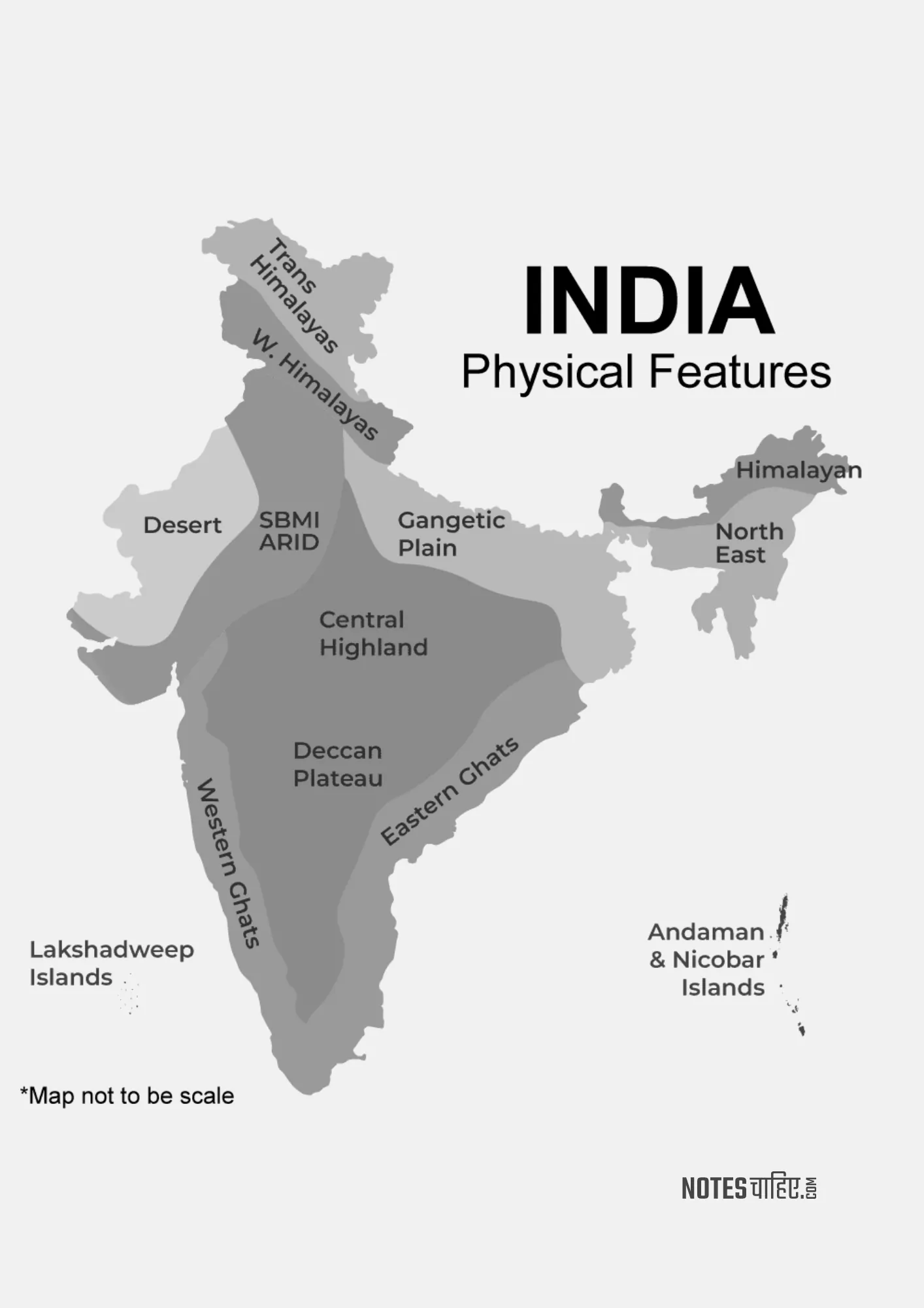
Physical Features Of India Tree Notes
- The Great Mountain of North (Himalaya)
- Himadri (Greater Himalaya)
- Himachal (Lesser Himalaya)
- Siwaliks (Outer Himalaya)
- Northern Plain
- Punjab Plains
- Ganges Plains
- Brahmaputra Plains
- Physical Features Divisions
- Bhabar Region
- Terai Region
- Bangar Region
- Kadar Region
- Peninsular Plateau
- Central Highland
- Malwa Plateau
- Chotanagpur Plateau
- Meghalaya Plateau
- Vidhya Range
- Satpura Range
- Aravali Range
- Deccan Plateau
- Central Highland
- Thar Desert
- Coastal Plains
- Eastern Coastal Plain
- Western Coastal Plain
- Islands
- Andaman and Nicobar
- Lakshadweep
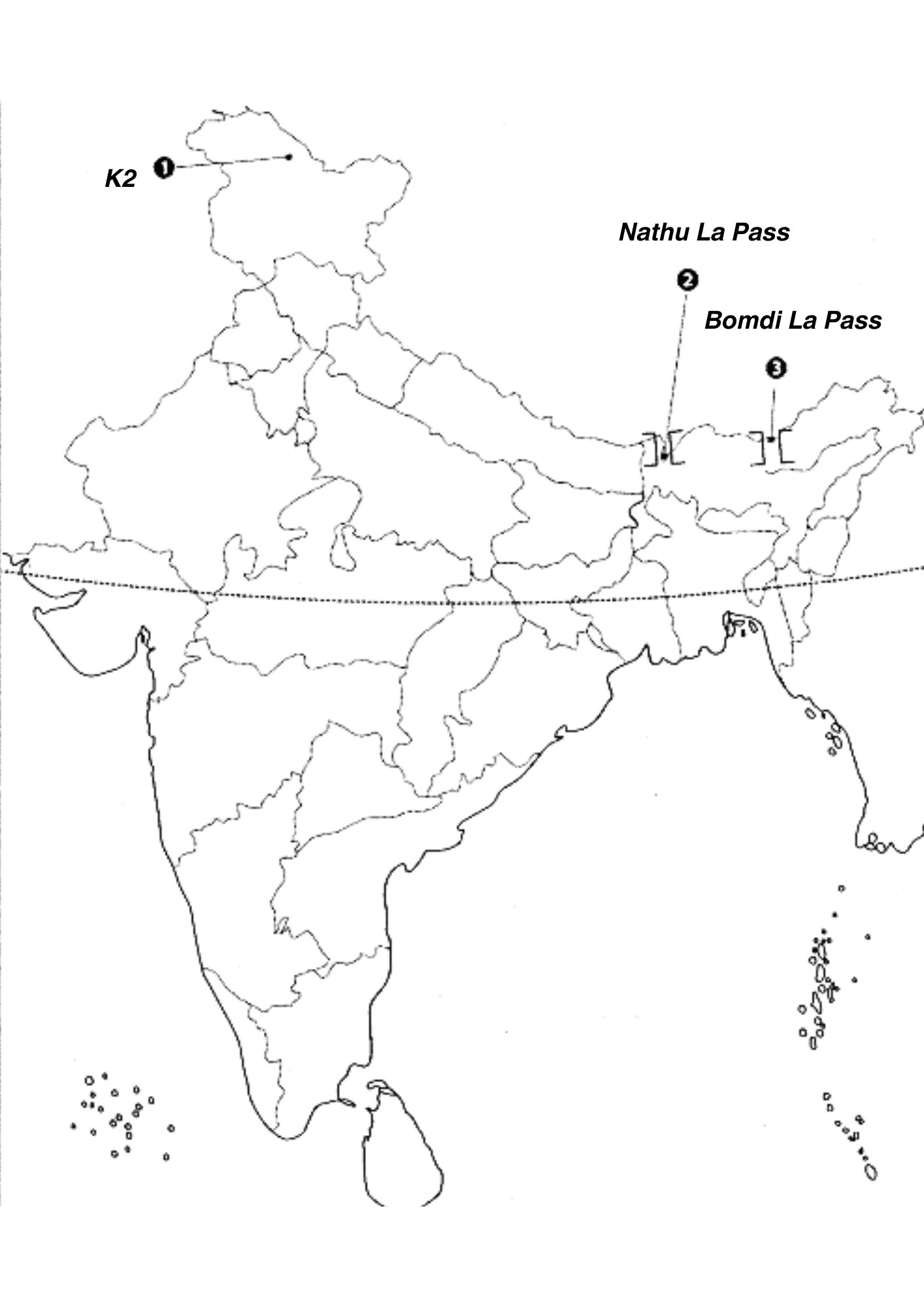
Physical Features Of India Map Work With Solution
Question 1.
Features are marked by numbers in the given political map of India. Identify these features with the help of the following information and write their correct names on the lines marked in the map.
1. The highest mountain peak of Himalaya in India
2. A mountain pass in Sikkim
3. A mountain pass in Arunachal Pradesh
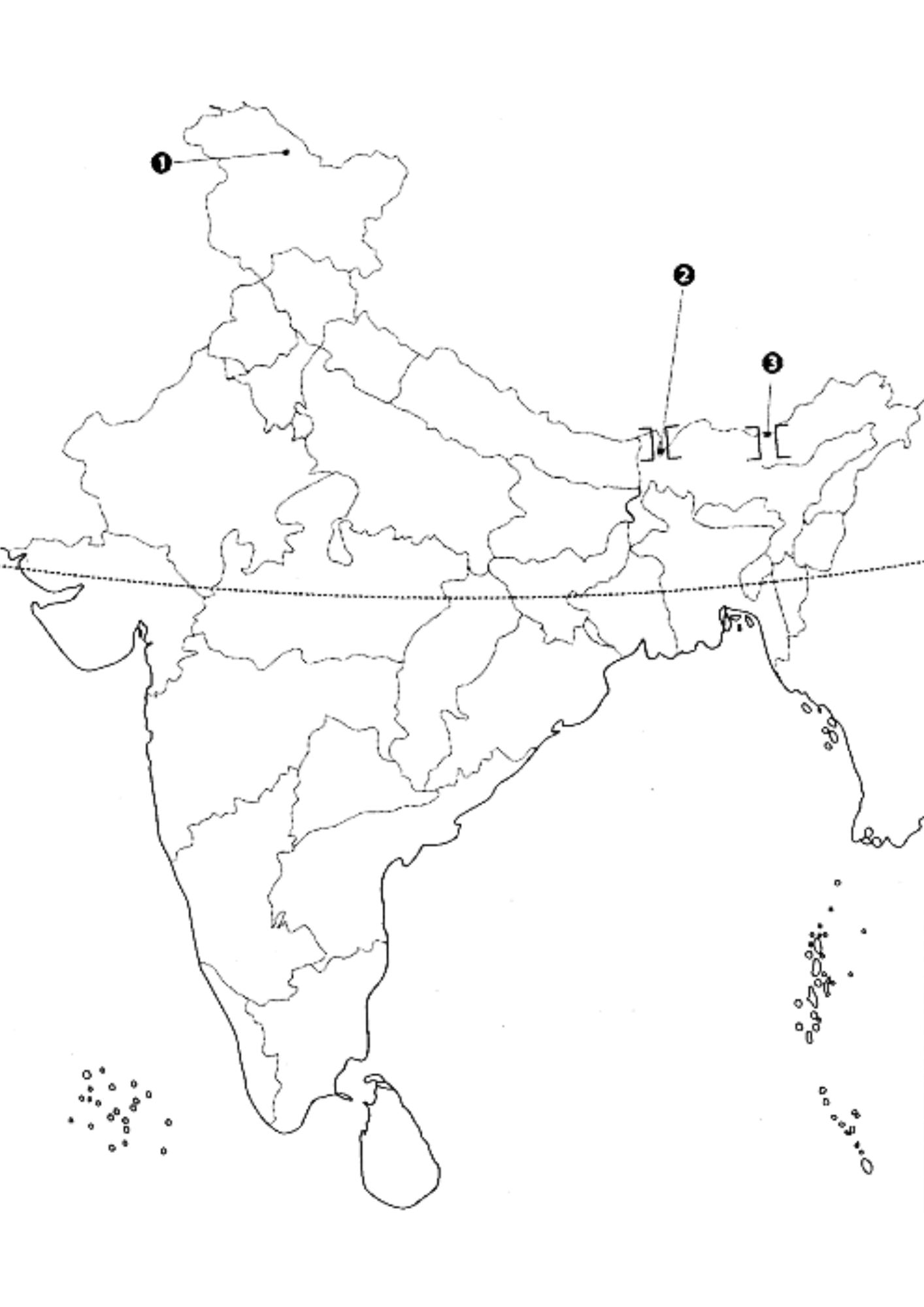
Answer:
- The highest mountain peak of Himalaya in India (K2)
- A mountain pass in Sikkim (Nathu La Pass)
- A mountain pass in Arunachal Pradesh (Bomdi La Pass)
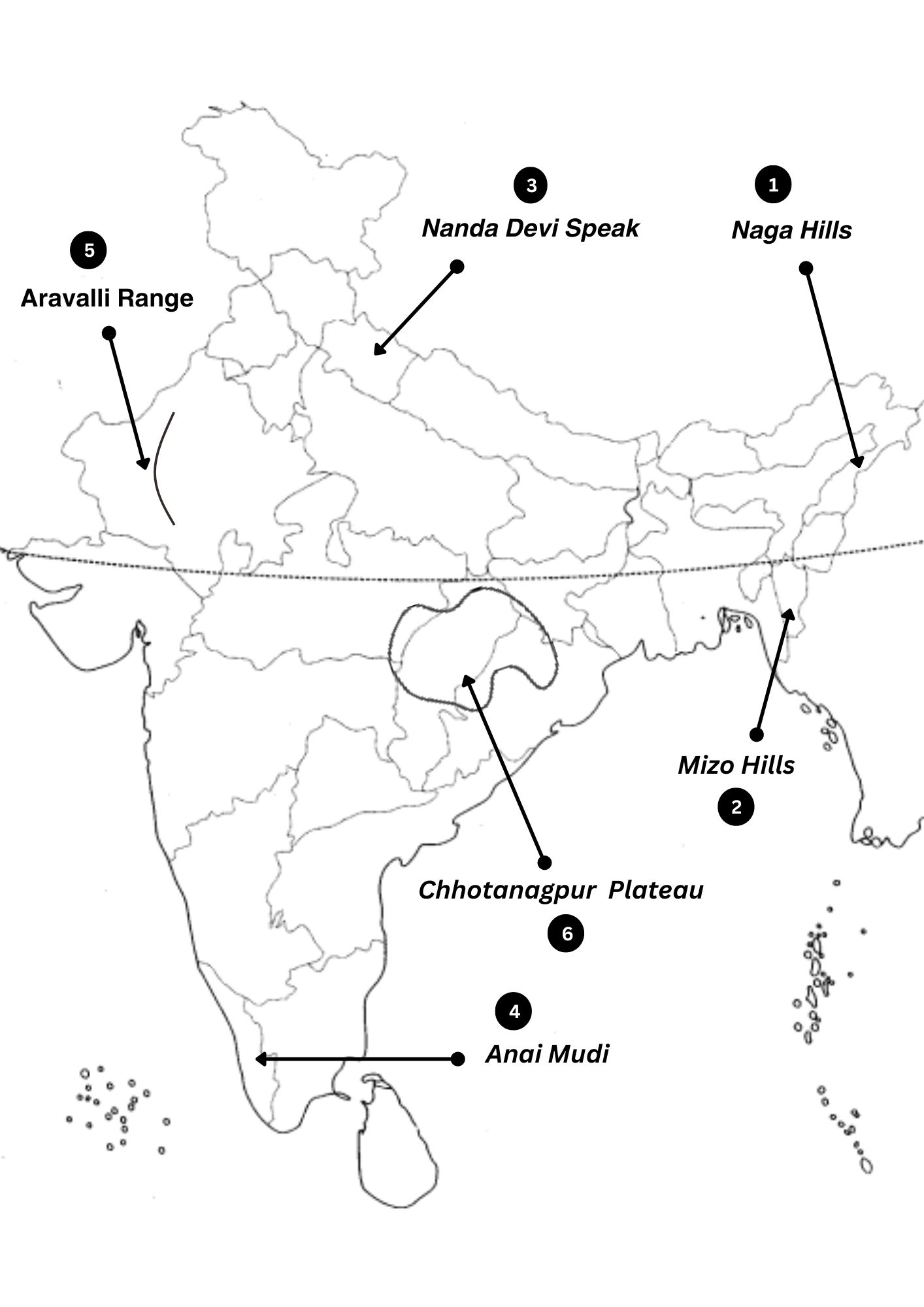
Question 2.
Locate and label the following items on the given map
1. Naga hills
2. Mizo hills
3. Nanda Devi peak
4. Anai Mudi
5. Aravali range
or
A mountain range in Rajasthan
or
The hill range forming the Western boundary of the Malwa plateau
6. Chhotanagpur plateau
or
An important plateau
Answer:
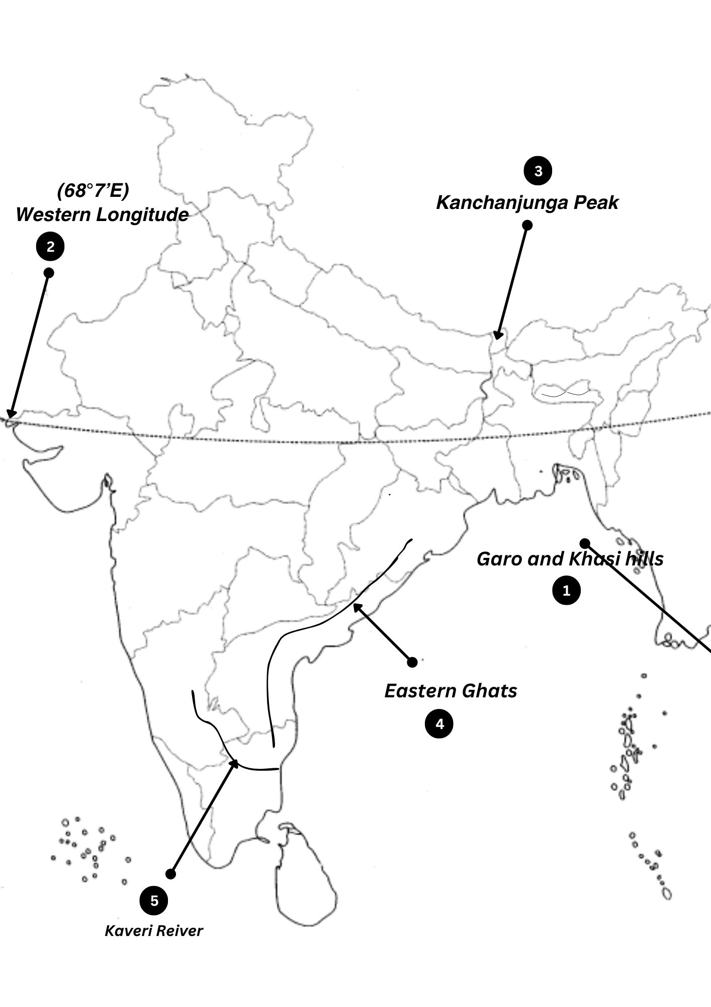
Question 3.
Locate and label the following items on the given map with appropriate symbols.
1. Garo and Khasi hills
2. Western Longitude
3. Kanchenjunga peak
4. Eastern Ghats
5. Kaveri river

Answer:
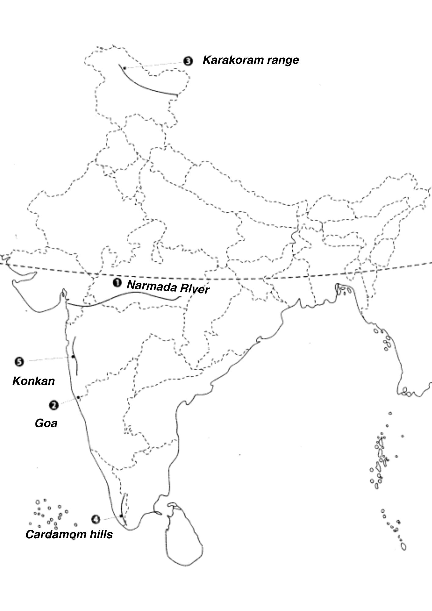
Question 4.
Features are marked by numbers in the given political map of India. Identify these features with the help of the following information and write their correct names on the lines marked in the map.
1. River of Peninsular India that forms an estuary
2. A mountain range
3. A South India hill range
4. A South Indian hill range
5. Western Coastal strip in the North
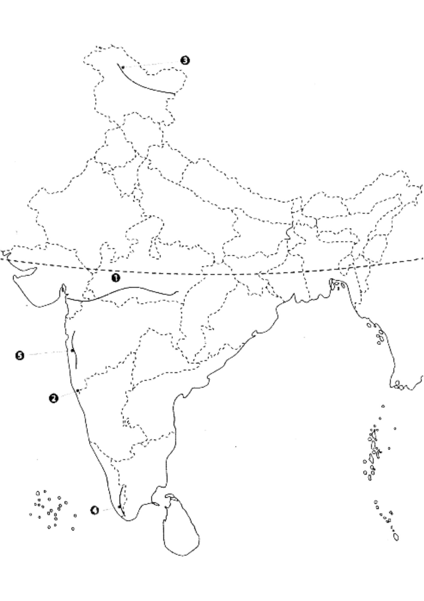
Answer:
1. Naramada river
2. Goa
3. Karakoram range
4. Cardamon hills
5. Konkan
Class Geography Chapter 2 NCERT Solution
Multiple Choice Questions:
- (i) A landmass bounded by sea on three sides is referred to as
- (a) Coast(b) Island(c) Peninsula(d) None of the above
- (ii) Mountain ranges in the eastern part of India forming its boundary with Myanmar are collectively called
- (a) Himachal(b) Uttarakhand(c) Purvachal(d) None of the above
- (iii) The western coastal strip, south of Goa is referred to as
- (a) Coromandel
- (b) Konkan
- (c) Kannad
- (d) Northern Circar
- (iv) The highest peak in the Eastern Ghats is
- (a) Anai Mudi
- (b) Kanchenjunga
- (c) Mahendragiri
- (d) Khasi
Brief Answers:
(i) What is the bhabar?
Answer: The bhabar is a narrow belt lying parallel to the Shiwalik slopes, where rivers deposit pebbles after descending from the mountains.
(ii) Name the three major divisions of the Himalayas from north to south.
Answer: The three major divisions of the Himalayas from north to south are Himadri, Himachal, and Shiwaliks.
(iii) Which plateau lies between the Aravali and the Vindhyan ranges?
Answer: The Malwa plateau lies between the Aravali and the Vindhyan ranges.
(iv) Name the island group of India having coral origin.
Answer: The Lakshadweep Islands is the island group of India having a coral origin.
Distinguish Between:
(i) Bhangar and Khadar
Bhangar: Older alluvium lying above floodplains.
Khadar: Newer, younger deposit of floodplains, renewed every year.
(ii) Western Ghats and Eastern Ghats
Western Ghats: Lie parallel to the Western Coast, continuous, with higher elevation and orographic rain.
Eastern Ghats: Lie parallel to the Eastern Coast, discontinuous, lower elevation, and dissected by rivers.
Major Physiographic Divisions:
Which are the major physiographic divisions of India? Contrast the relief of the Himalayan region with that of the Peninsular plateau.
Answer: The major physiographic divisions are the Himalayan Mountains, Northern Plains, Peninsular Plateau, Indian Desert, Coastal Plains, and Islands. The Himalayan region has youthful topography, while the Peninsular plateau is ancient with gently rising hills.
Give an account of the Northern Plains of India.
Answer: The Northern Plains are formed by the interplay of the Indus, Ganga, and Brahmaputra rivers, with fertile alluvial soil. It is agriculturally productive with diverse relief features.
Short Notes:
(i) The Indian Desert
Answer: The Indian Desert lies in the western margins of the Aravali Hills, characterized by an undulating sandy plain and low rainfall.
(ii) The Central Highlands
Answer: The Central Highlands cover the Malwa plateau north of the Narmada river, wider in the west and narrower in the east.
(iii) The Island groups of India
Answer:
Lakshadweep Islands: Small coral islands in the Arabian Sea.
Andaman and Nicobar Islands: An elongated chain in the Bay of Bengal, divided into Andaman and Nicobar.
Leave a Reply